Summary
- Coordinates: 51°58’12.81″N, 4°55’34.33″E
- Height: 213 m
- Base level: -2m ASL
- Country: Netherlands
- InGOS observations: CH4, N2O, SF6, H2, 222Rn, fluxes of CH4 and N2O
- Responsible partner: ECN
- Responsible PI: Arjan Hensen (hensen@ecn.nl)
- Link to TNA access request page
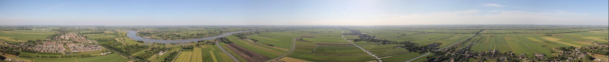
360 degrees Cabauw panorama
General
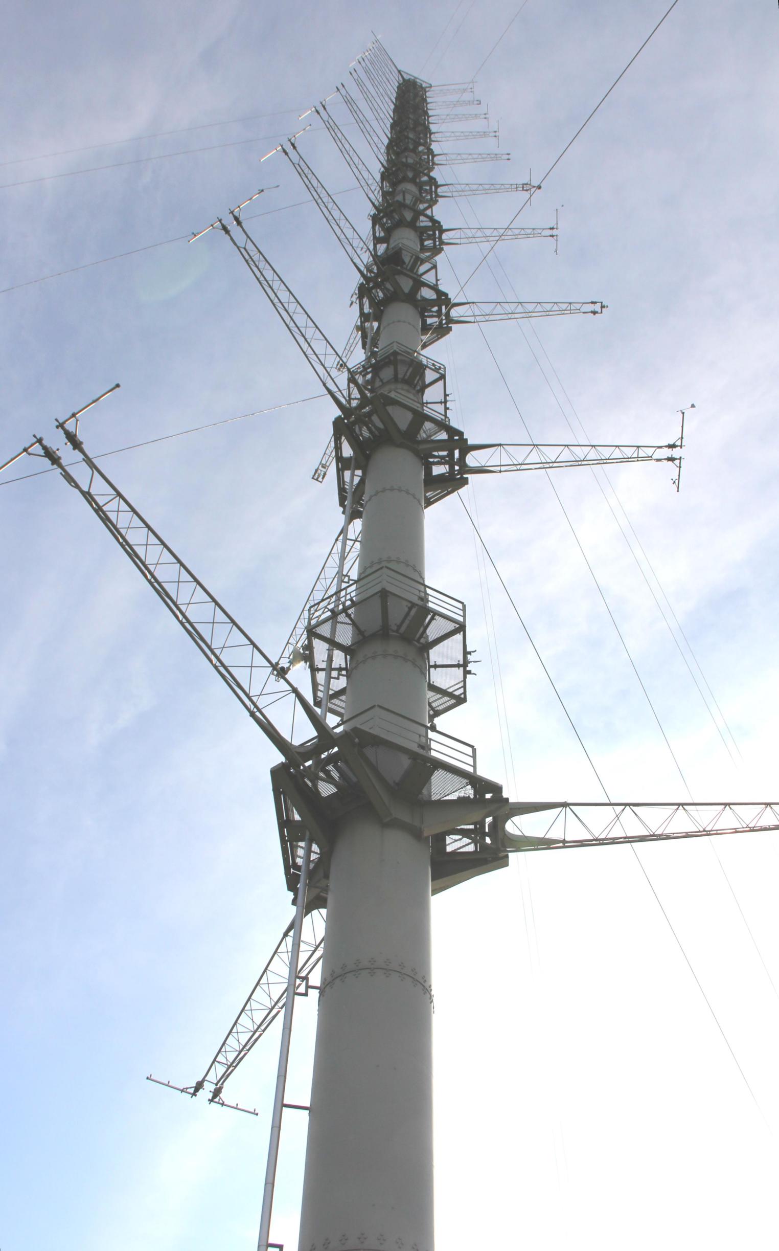
Cabauw tower
Cabauw tower is owned and operated by the Netherlands MetOffice KNMI. It is a super site for (micro)-meteorological, air pollution, aerosols, greenhouse gas, climate and remote sensing observations. A consortium existing of 8 Dutch institutes use the tower as a platform for their observations: CESAR. Other projects besides InGOS where Cabauw plays an important role are for example ACTRIS and PEGASOS. The tower is a steel structure with a diameter of 2 meter. Half of the inside is in use by the elevator. The other half has a stair and platforms every 2.5 meter. Outside the tower is equipped with platforms and three horizontal arms at every 20 meter height. The arms can be lifted hydraulically for mounting or maintaining equipment.
Cabauw has already been in use for greenhouse gas observations by ECN since 1992, starting of with CO2 and CH4 at 200m AGL. Since 2000 concentrations are measured at four elevations: 20, 60, 120 and 200m AGL. In 2004 the high precision measurements in the framework of the CHIOTTO project started with observations of CO2, CH4, N2O, CO and SF6. In 2007 H2 vertical gradient observations were added. In 2006 and 2007 222Rn observations were added at 200m and 20m AGL respectively.
KNMI and WUR also operate CO2 flux observations at three elevations.
The area of Cabauw is very flat and main land use is agriculture with predominantly grassland on peat/clay mixed soil type. At the east of the tower you find a small town called Lopik. Bigger cites are like Utrecht NE, 20 km), Rotterdam (WSW, 30 km), The Hague (W 40 km) and Amsterdam (N, 40 km) can be seen from the top of the tower under very clear conditions. At 2 km south of the tower the river Lek (leg of river Rhine) meanders from east to west, surrounded by orchards on the fertile river banks covered with river clay.
Infrastructure and facilities
The measurement equipment is mainly located in the large cellar under the central building of the tower. Temperature is very stable and a large floor area is available (>200 m2). Air is drawn through 1/2″ dekabon tubing from the measurement levels for analysis. Air is dried by permapure dryers at the inlet to dewpoints around -5 oC and in the cellar further by cryocoolers to dewpoints below -40 oC. Equipment can also be installed at the tower, inside the steel pipe or outside at a platform, after consultation of the tower owner.
Power is available at request up to 16A, 230V or eventually also 380V can be supplied.
Surrounding the tower a large grassland area of several ha is part of the facility. Part of this is used for (micro)meterological, climate and remote sensing observations.
The tower is equipped with a high speed internet connection.
The tower can be reached by public transport (bus from Utrecht) or car, the highway A2 exit IJsselstein is approximately 15 km from Cabauw tower.
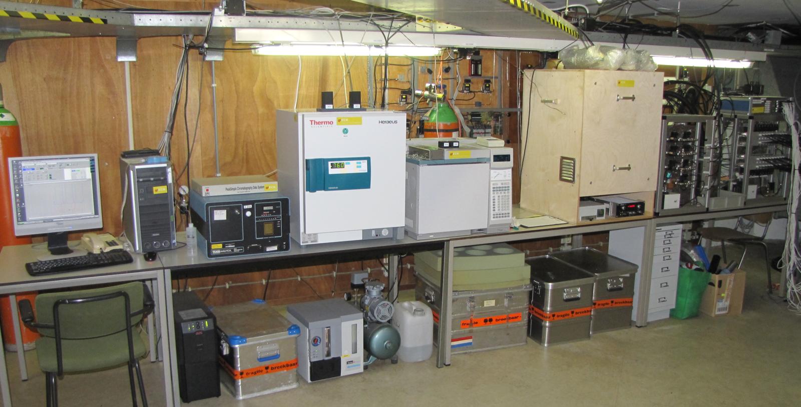
Measurement equipment below tower
References for Cabauw observations
- Popa, M. E., Vermeulen, A. T., van den Bulk, W. C. M., Jongejan, P. A. C., Batenburg, A. M., Zahorowski, W., and Röckmann, T.: H2 vertical profiles in the continental boundary layer: measurements at the Cabauw tall tower in The Netherlands, Atmos. Chem. Phys., 11, 6425-6443, doi:10.5194/acp-11-6425-2011, 2011
- Vermeulen, A. T., Hensen, A., Popa, M. E., van den Bulk, W. C. M., and Jongejan, P. A. C.: Greenhouse gas observations from Cabauw Tall Tower (1992–2010), Atmos. Meas. Tech., 4, 617-644, doi:10.5194/amt-4-617-2011, 2011.
- Arnold, D., Vargas, A., Vermeulen, A. T., Verheggen, B., and Seibert, P. : Analysis of radon origin by backward atmospheric transport modelling. Atmos. Environ., 44, 494-50, 2010